

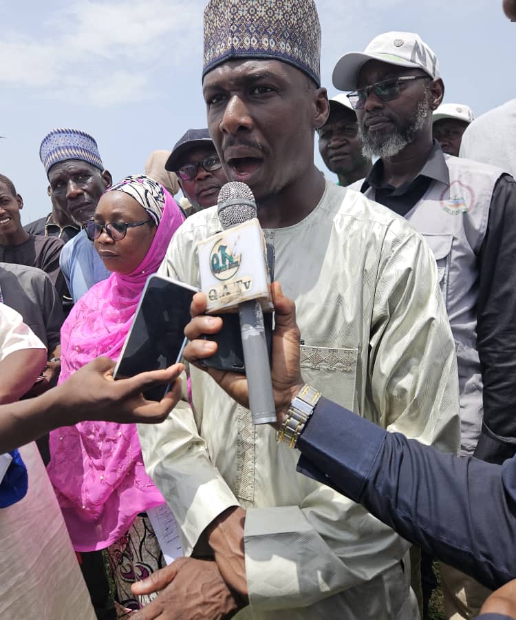
By Maryam Zanna Gambo
The Commissioner for Works and Housing Engr. Adam Bukar Bababe has urged communities to always verify facts before taking sides in land and title disputes, warning that misinformation and hasty conclusions can fuel unnecessary conflict.
Engr. Bukar Bababe who led The Borno Geographic Information Service (BOGIS) towards resolving land disputes in BOSA 11, Muna Asheri, and BOSA 201, Bulabulin Ngarannam layouts under Jere Local Government Area, following concerns over conflicting allocations, ownership claims, and other land administration issues.
Engr. Adam Bukar Bababe brought together titleholders, occupants, community leaders, and other stakeholders at Bulabulin Ngarannam community, to deliberate on issues surrounding the layouts, noting that government’s intervention was aimed at finding lasting solutions to the disputes through proper verification and documentation.
Engr. Bababe explained that the area was initially a government reserved area but was later designed and allocated by Jere Local Government in 2016 due to increasing demand and the need to accommodate development needs.
The Commissioner further said many land disputes arise from failure by some allottees to comply with the terms and conditions of their allocations, including failure to develop plots within the stipulated period, leading to conflicts between previous allottees, subsequent beneficiaries and illegal buyers.
At Muna Asheri, Engr. Bababe explained that the layout was originally designed in 1982, with only five people developing their plots, before it was amended, redesigned and reallocated in 2016.
He assured residents that government would address the concerns through verification, capturing of existing structures and proper documentation to determine legitimate claims and achieve an amicable resolution.
District Heads of Dusuman and Old Maiduguri, Abba Kyari Terab and Abba Umar Shehu, commended the intervention, describing it as a welcome development that would promote peaceful coexistence among affected communities.
Following the deliberations, Engr. Bababe directed survey teams to visit the affected areas to capture existing structures, establish boundaries and document the layouts, while warning against further development on disputed portions pending completion of the verification exercise.








Leave a Reply